Current Conditions
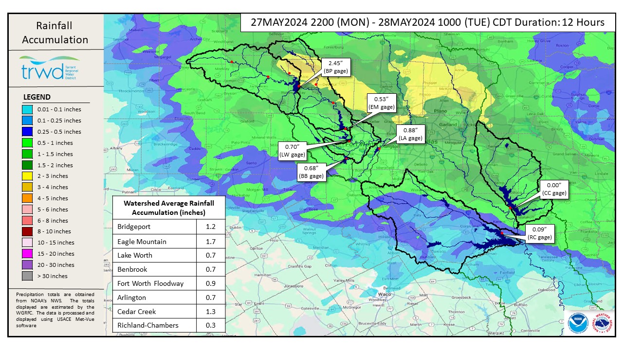
- Past 12-hour rain depths shown in Graphic-1.
- Heavy rainfall in the Eagle Mountain (EM) watershed this morning.
- Cedar Creek (CC) discharges have increased with additional rain
Projections
- Too early for projections at this time
- Staff will be monitoring as runoff is expected at all TRWD lakes
Looking Forward
More rainfall is expected this week. Tonight and overnight Thursday are the best chances for heavy rainfall. See Graphic-2 and 3 for the latest NWS guidance. Bridgeport is +11 ft below conservation and has plenty of room to catch the runoff. The other TRWD lakes, including EM, are near or over full. TRWD staff will continue to monitor conditions and flood discharges will be adjusted accordingly.
Please stay weather aware and follow our partners at the National Weather Service (NWS) and the River Forecast Center (RFC) for the latest information regarding weather and river conditions, respectively.
Current TRWD lake conditions are shown below. Be sure to subscribe to receive e-mail notification of any new Lake Level Blog posts. You can also follow @TRWD_News on X (formerly known as Twitter) to receive Lake Level blog notifications.
Next update will come when conditions warrant. Please subscribe or check back when lake levels are on the rise.
Graphic-1. 12-hour Rainfall Totals
Graphic-2. NWS Tuesday Night Guidance
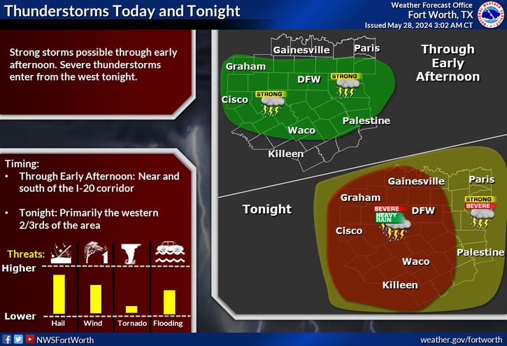
Showers and thunderstorms will roll through the I-20 corridor this morning, a few of which may be strong to marginally severe. Additional storms will enter from the west this evening , some of which may be severe with large hail and damaging winds. A tornado or two cannot be ruled out. Heavy rain may also cause flooding in some areas.
Graphic-3. NWS Thursday Night Guidance
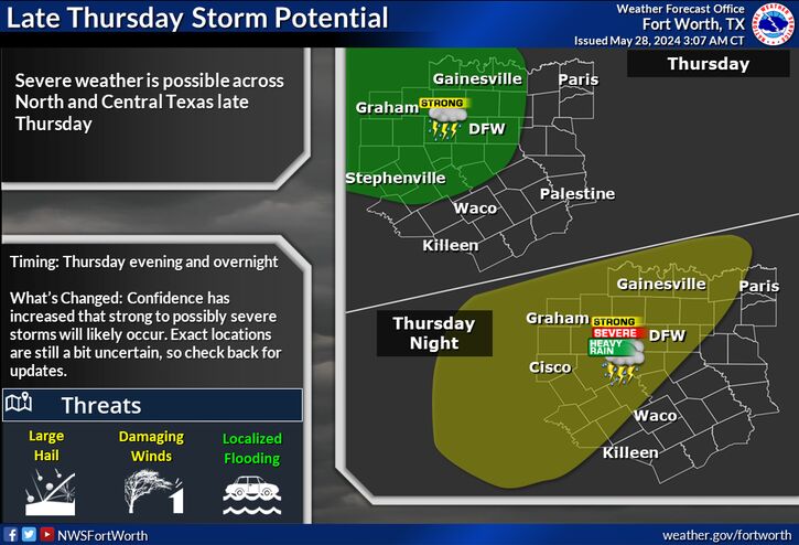
The potential for severe weather will return late Thursday as another round of thunderstorms enters from the west or northwest. Large hail, damaging winds, and locally heavy rain will be possible, especially west of the I-35 corridor.
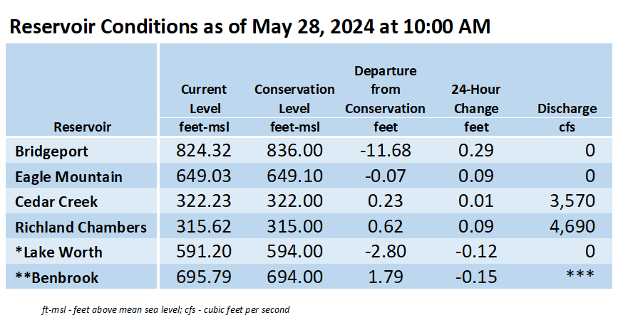
*Lake Worth is owned and operated by the City of Fort Worth. See the City of Fort Worth news feed and NWS forecast page for updates on Lake Worth.
**Benbrook Lake is owned and operated by the U.S. Army Corps of Engineers. ***See Benbrook Lake Home Page for current discharge.
Current lake levels can be found in a variety of locations including TRWD.com, the TRWD watershed data viewer trwd.onerain.com, or download the TRWD Lake Level App for iOS or Android.
Please call the Flood Hotline for further information.
817-720-4296
If prompted to leave a message, the flood monitor on duty will return your message within 30 minutes.
Posted by CO