Current Conditions
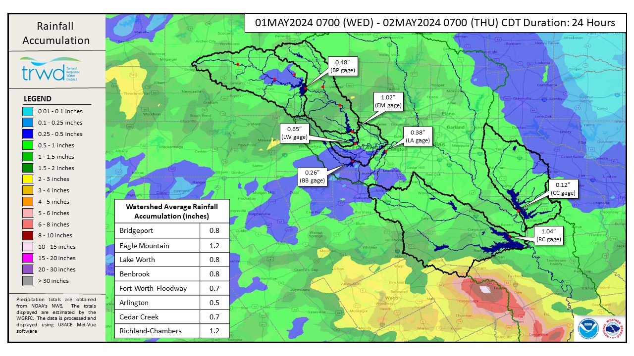
Rain fell overnight across all TRWD watersheds. The system that moved through overnight has made its way eastward out of the TRWD watersheds this morning. See Graphic-1 for a map of the rainfall depths from the past 24-hours as of 7 am. TRWD watersheds saw an average of 0.8 to 1.2 inches. Heavier rainfall totals fell just south of the Richland-Chambers watershed.
Both Richland-Chambers and Cedar Creek remain above conservation and continue flood releases. Inflows are expected to increase from this most recent rain event as watersheds are already quite saturated. TRWD staff will adjust releases as needed to safely pass additional inflows from this most recent rain event to manage lake levels and downstream conditions as safely as possible. All changes to releases will be posted to the Lake Level Blog. The West Fork lakes (Bridgeport and Eagle Mountain) have plenty of room to store the runoff generated by the rain.
Looking Forward
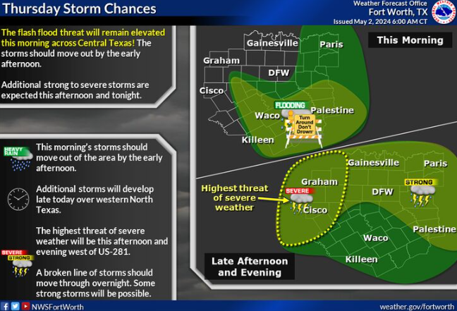
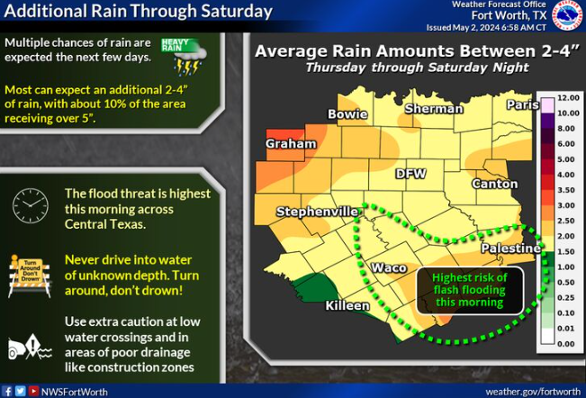
Multiple storms are possible this afternoon and tonight. The severe weather threat this afternoon/evening is focused west of the metroplex. This pattern is expected to continue through Saturday night when another round of storms is expected. See Graphic-2 for NWS guidance on upcoming rain. Forecasts from NWS are subject to change. Please follow our partners at the National Weather Service (NWS) and the River Forecast Center (RFC) for the latest information regarding weather and river conditions, respectively.
Current TRWD lake conditions are shown below. Be sure to subscribe to receive e-mail notification of any new Lake Level Blog posts. You can also follow @TRWD_News on X (formerly known as Twitter) to receive Lake Level blog notifications.
Next update will come when conditions warrant. Please subscribe or check back when lake levels are on the rise.
Graphic-1. Rainfall Totals from the past 24-hours
Graphic-2. NWS Guidance
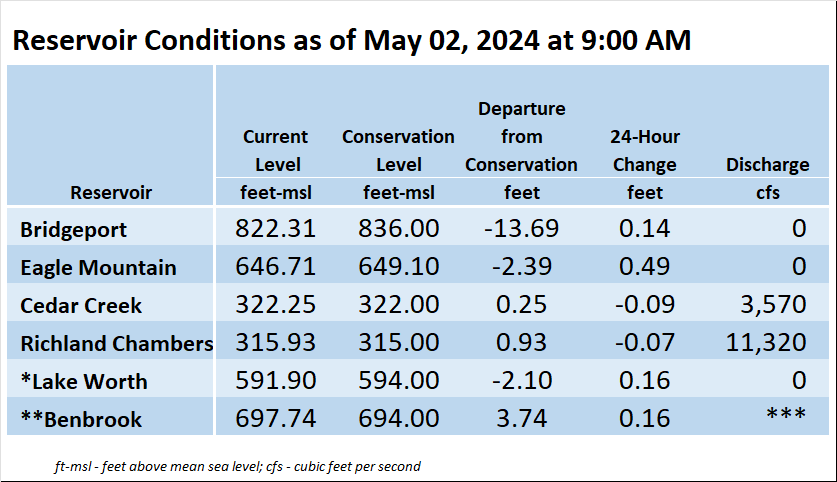
*Lake Worth is owned and operated by the City of Fort Worth. See the City of Fort Worth news feed and NWS forecast page for updates on Lake Worth.
**Benbrook Lake is owned and operated by the U.S. Army Corps of Engineers. ***See Benbrook Lake Home Page for current discharge.
Current lake levels can be found in a variety of locations including TRWD.com, the TRWD watershed data viewer trwd.onerain.com, or download the TRWD Lake Level App for iOS or Android.
Please call the Flood Hotline for further information.
817-720-4296
If prompted to leave a message, the flood monitor on duty will return your message within 30 minutes.
Posted by ASL