The latest lake level projections are shown below. You will also find:
- Links to historical lake level plots
- Last month’s projections compared to what actually happened
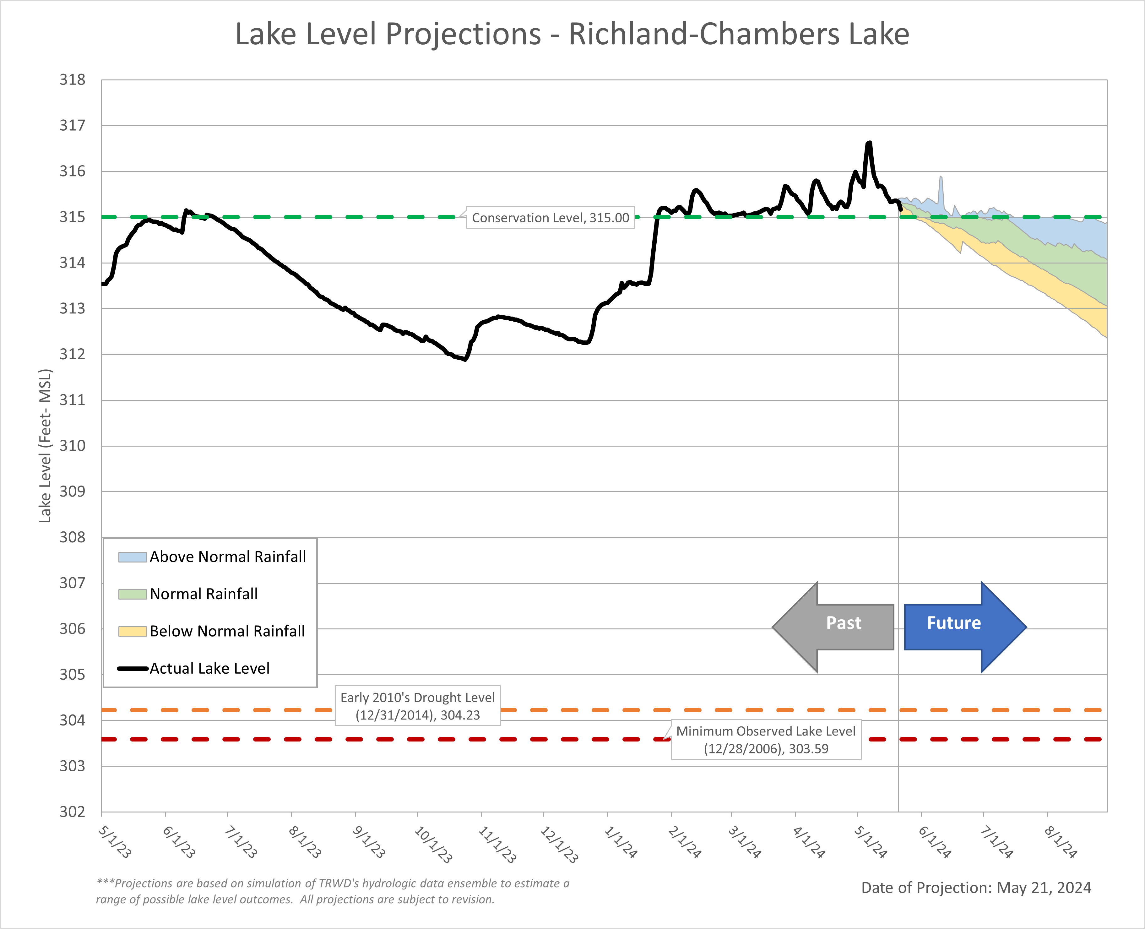
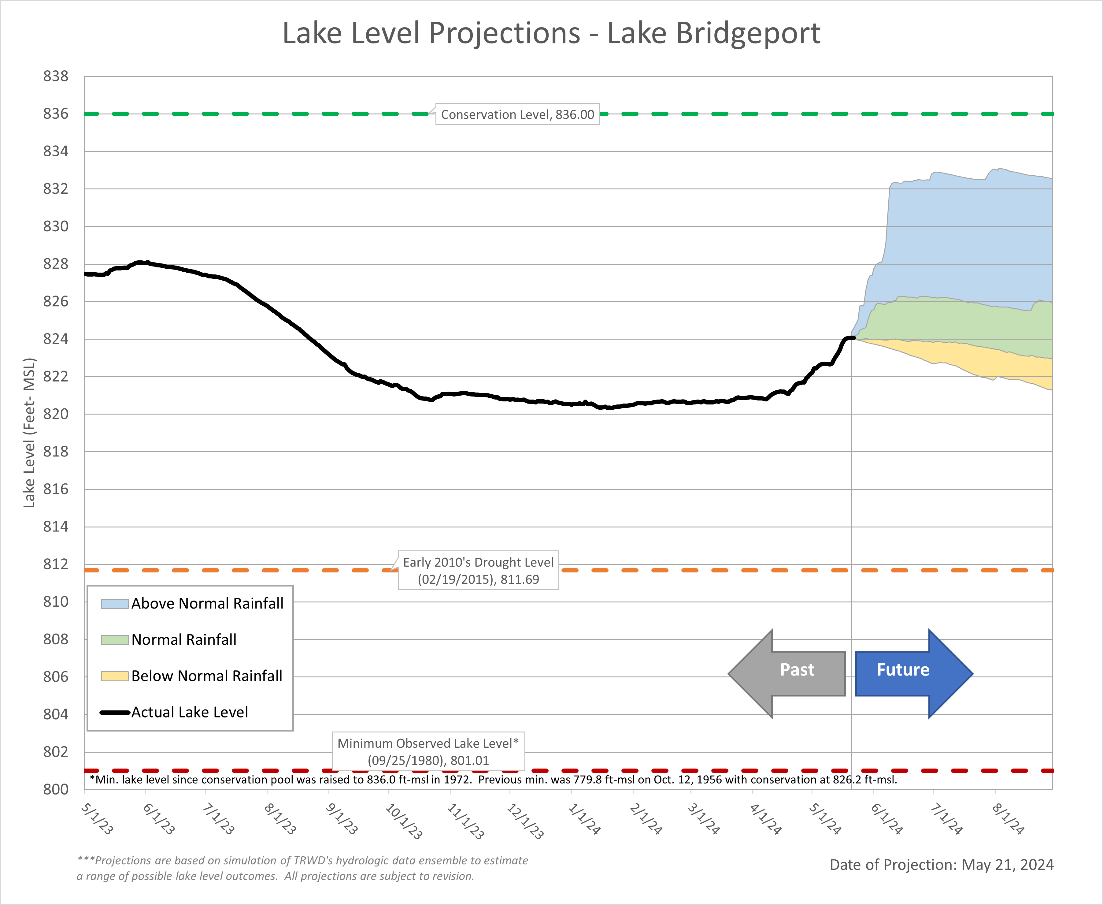
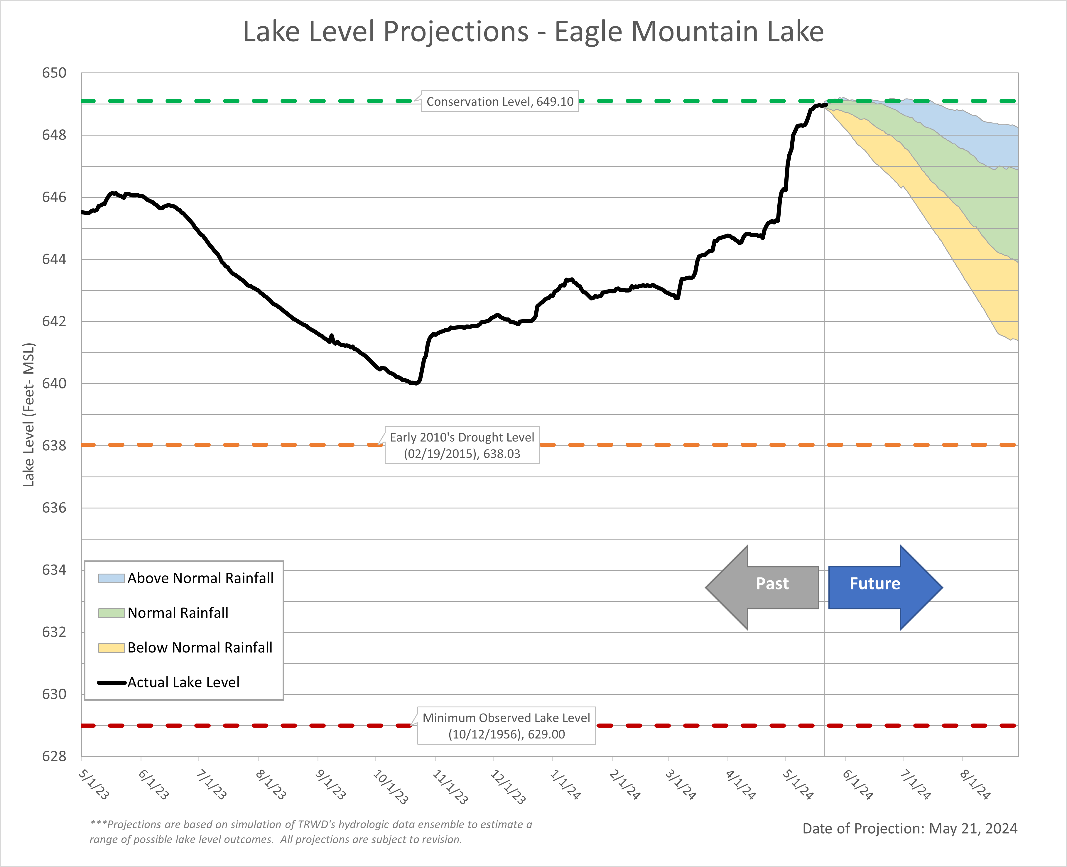
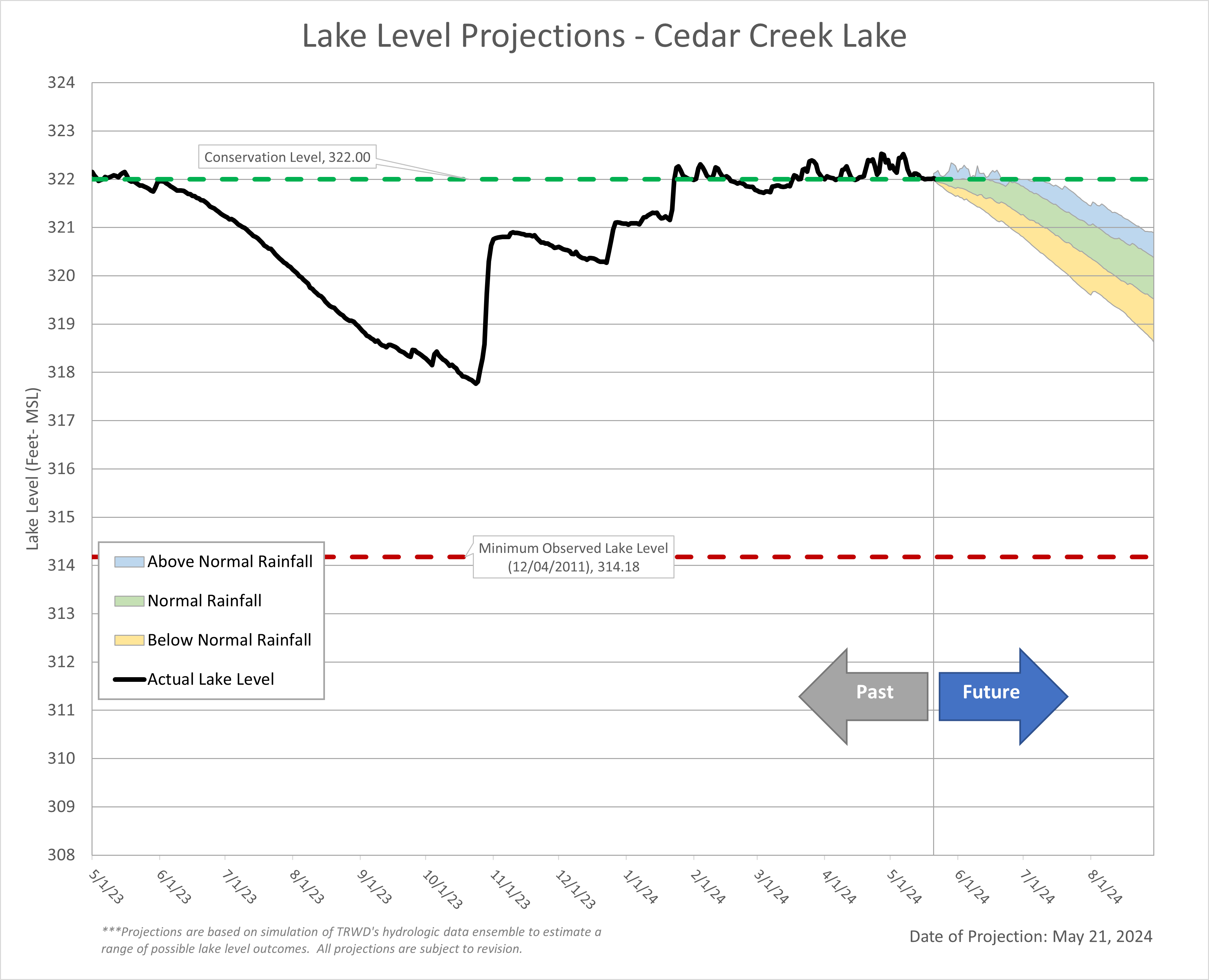
May rains added to an already wet spring. The East Texas Lakes (Cedar Creek and Richland-Chambers), which have been full for over a month, continue to release flood water. The West Fork system (Bridgeport and Eagle Mountain) have benefited from the rain with Eagle Mountain and Bridgeport pools gaining approximately 4 ft and 3 ft, respectively, in elevation. This corresponds to an increase of about 10% in total West Fork storage (currently at 76%). Overall, TRWD system storage is around 95%. TRWD’s Meteorologist, Courtney Jalbert, provides information on what we can expect in terms of rainfall and the impact to lake levels in the “From our Meteorologist” section.
Thank you for following the Lake Level Blog and check back next month for more projections.
From our Meteorologist
May Summary…
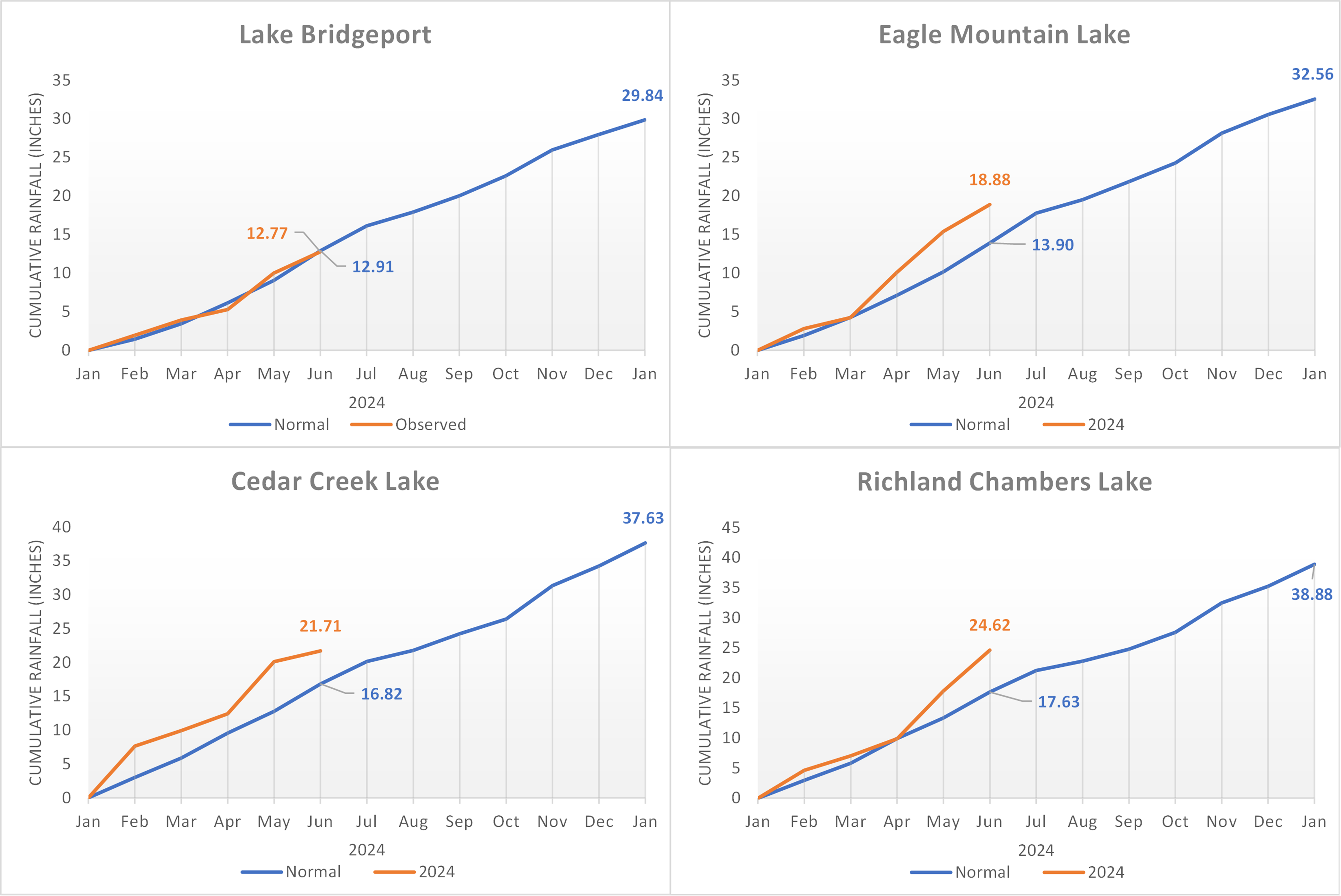
As a pleasant spring comes to a close, North Texas has experienced an overall slightly warmer and wetter season. The generous rainfall so far this year has been ranked the 7th wettest year since 1974 at DFW as of May 22nd with 21.01” of rainfall. TRWD Reservoirs have received well above normal rainfall for the year, with the exception of Bridgeport who has received right around normal. This trend can be clearly seen as depicted in the Year to Date Percent Precipitation Map. The month of May will close out with a few more slight chances of rain/thunderstorms before meteorological summer begins. See the past 30 days rainfall totals below.
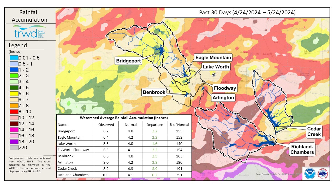
TRWD Lake Rainfall Totals though May 24, 2024
The great news is that, due to the rainfall North Texas has received the last few months, all drought intensity for the region has been cleared.
Looking ahead…
Models indicate a wet pattern will continue with a southerly return flow around a surface high in early June bringing a higher chance of rain as indicated in the Climate Prediction Center 6-10 Day and 8-14 Day Outlooks.
In the Pacific, a transition from El Nino to ENSO-neutral is almost complete. El Nino generally brings a wetter weather pattern over North Texas than ENSO-neutral years during Apr-May-Jun. However, during this transition the precipitation forecast becomes more challenging in the extended June-July-August Precipitation outlook where North Texas sits between an expected above normal probability of precipitation to the east and below normal probability of precipitation to the west. Unfortunately, the climate models have a little bit more confidence in a warmer than normal summer in the June-July-August Temperature Outlook for the entire state of Texas.
Projections
Lake Bridgeport
Eagle Mountain Lake
Cedar Creek Lake
Richland-Chambers Lake