Every time there’s a downpour, residents who live near Creek Trail Park in Richland Hills get a little nervous.
The roughly five-acre park, located along the Calloway Branch, an urban stream in the Trinity River basin, tends to flood. At times, the water covers the park and cuts off access to a neighborhood on the park’s eastern edge.
City officials want to fix the problem, but don’t have the expertise or staff.
That’s why Richland Hills officials reached out to the Tarrant Regional Water District’s Watershed Protection Program for help in not only finding a solution, but also seeking ways to raise money to pay for it.
It wasn’t long before the District recommended the city write its own watershed protection plan (WPP) for the area. Another suggestion was to form a nonprofit to accept grants to not only help pay for the WPP itself, but to fund its recommended improvements.
“There are ways to slow down the water, control the erosion, create cool green spaces and cut down on trash in the Trinity River,” said Michelle Wood-Ramirez, Urban Program Coordinator for the watershed program.
“I think once people see it’s all connected, that it’s aesthetic and it’s functional, then they get excited. Everyone benefits,” she said.
Protecting the drainage areas of the four reservoirs that comprise the TRWD water supply is a major mission at the District.
Covering about 5,000 square miles, the watersheds include large swaths of rural land as well as numerous fast-growing cities. TRWD provides raw water to 2.4 million people in 11 counties.
Determining the quality of that water supply means managing what happens in those watersheds, or drainage areas. Activities far upstream can affect the amount and quality of water in a creek or lake miles away.
Streams, ponds, rivers and reservoirs are challenged by the impacts of past farming and ranching practices and the land use changes brought about by growing urban, suburban and exurban populations.
Stormwater runoff and wastewater flows into streams, lakes and reservoirs, putting stress on watersheds and drinking water supplies.
Helping stakeholders
TRWD’s Urban Watershed Protection Program helps stakeholders such as landowners, residents, elected officials and agency representatives work together to produce comprehensive plans to reduce pollution in the water.
“I think water is really important to everyone,” Wood-Ramirez said. “It bridges the environment, it bridges every group, it bridges every person. Everyone needs water and everyone wants clean water.”
“But water is finite, and the issues are complicated,” she said.
Since watershed protection is a voluntary process, as the Urban Program Coordinator, Wood-Ramirez works largely in the background. She helps individuals, municipalities and other entities learn about the best management practices for managing urban runoff and erosion. She also supports research and regional projects.
“We don’t have any (regulatory) teeth. We want to offer carrots. We want to help them with their goals,” Wood-Ramirez said.
One way Wood-Ramirez shows the benefits of these best management practices is by conducting tours of the District’s award-winning Rainscapes project at TRWD’s Fort Worth headquarters.
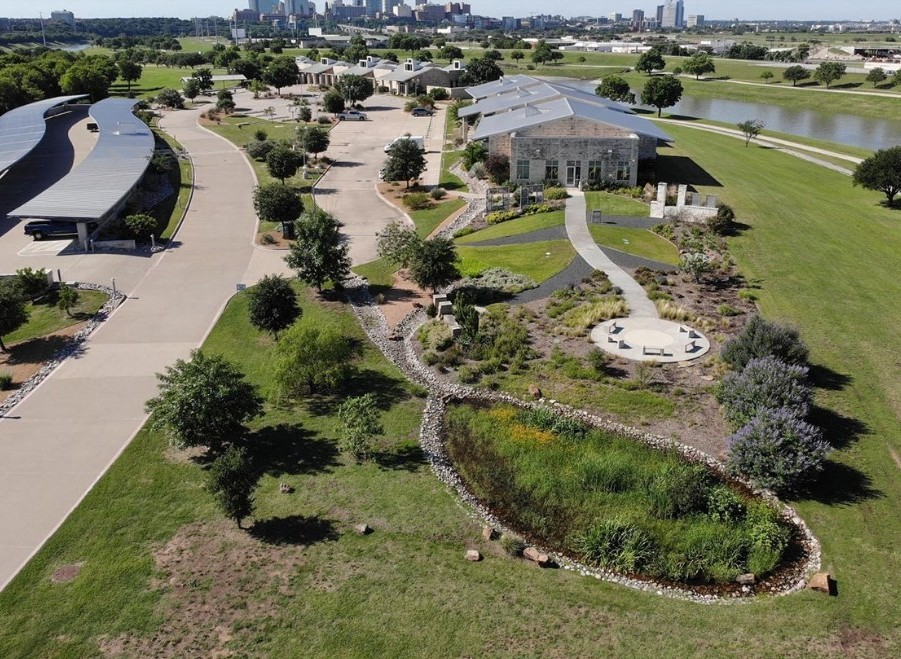
The TRWD Rainscapes is an example of how commercial and residential landowners alike can economically and ecologically protect water quality by using green stormwater infrastructures like bioswales, permeable surfaces and native and adapted plants to control and treat stormwater runoff.
Implemented in 2015, the TRWD Rainscapes treats each raindrop. Some are collected in a rain garden before seeping into the soil, while runoff that flows from the rooftops goes into cisterns. There’s even a 41,500-square-foot wetland that was built where a malfunctioning and unsightly detention basin used to be.
The District’s Watershed Program has also partnered regionally to create a Blue Green Infrastructure Network, or BGIN, to spread the word about using green stormwater tactics. A collaboration of agencies, academics, naturalists, homeowners and concerned citizens, the group meets to swap ideas and to discuss the challenges they face.
“We’ll have discussions about what’s been done and what’s been done well and lessons learned, specifically in our region,” Wood-Ramirez said.
Sold on the idea
Jason Brown is a true believer in the message Wood-Ramirez is pushing.
As Richland Hills parks director, Brown is the one who reached out to Wood-Ramirez and the watershed protection program for help with flooding in Creek Trail Park. He said the city has spent tens of thousands of dollars on replacing fences and making playground repairs after a flood.
The causes of flooding stem from channelization of the Calloway Branch in neighboring upstream cities years ago. Fast-moving water comes barreling down the concrete channel and then hits the winding, natural stream in Richland Hills, causing it to leave its banks.
“It (flooding) doesn’t happen a lot, but when it does, it tends to be devastating,” Brown said.
Then, Wood-Ramirez stepped in with the recommendation of a non-profit and a WPP. Brown was sold. He’s attended several watershed protection workshops and has since left Richland Hills to develop a business consulting other cities on blue green infrastructure.
“When I found blue green initiatives, I was blown away,” Brown said. “There isn’t enough talk about it.”
Wood-Ramirez said the word is getting around about watershed protection, blue green infrastructure and water quality.
“It’s getting better. It’s not an avalanche, but there are enough people saying it and I think we’re building a movement and a momentum,” she said.

