Even though we experienced some warm days, early September brought fall-like temperatures and rain which reduced demands and evaporation. This helped slow the decline of TRWD’s total system storage. TRWD’s Meteorologist, Courtney Jalbert, provides information on what we can expect in terms of rainfall and temperatures going into the next couple of months and their impacts to lake levels in the “From our Meteorologist” section.
The latest lake level projections are shown below. You will also find:
- Links to historical lake level plots
- Last month’s projections compared to what actually happened
Thank you for following the Lake Level Blog and check back next month for more projections.
From our Meteorologist
September Summary…
September was a wild rollercoaster of temperatures. North Texas had our first taste of fall early in the month and September 9th was almost 9 degrees below normal. Summer wasn’t done though! Temperatures rose again and peaked on the 19th at 10 degrees above normal with 96˚. Fall made its return on the 23rd and more seasonal temperatures should prevail through the end of the month. Opposite of what we typically see, the western part of the region received much higher values of rainfall compared to East TX for September as seen in the past 30 days precipitation map below. Bridgeport received 4.20”, and Eagle Mountain 4.6” as opposed to Cedar Creek with 1.80”, and Richland Chambers at 2.40” for the month so far. Right in the middle (at DFW) there has been 2.14” of rainfall recorded, which is only 0.03” below the normal. It looks like temperatures will remain more seasonal briefly before heating up into the 90s with dry conditions to close out the end of the month.
30-Day Rainfall Totals
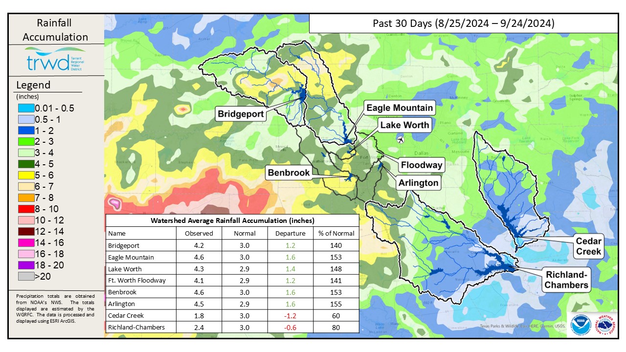
Drought intensity decreased for areas south and west of DFW with the abundant rainfall over the last month. However, D0, Abnormally Dry and D1, Moderate Drought still cover all four TRWD reservoir regions as seen on the local drought intensity map.
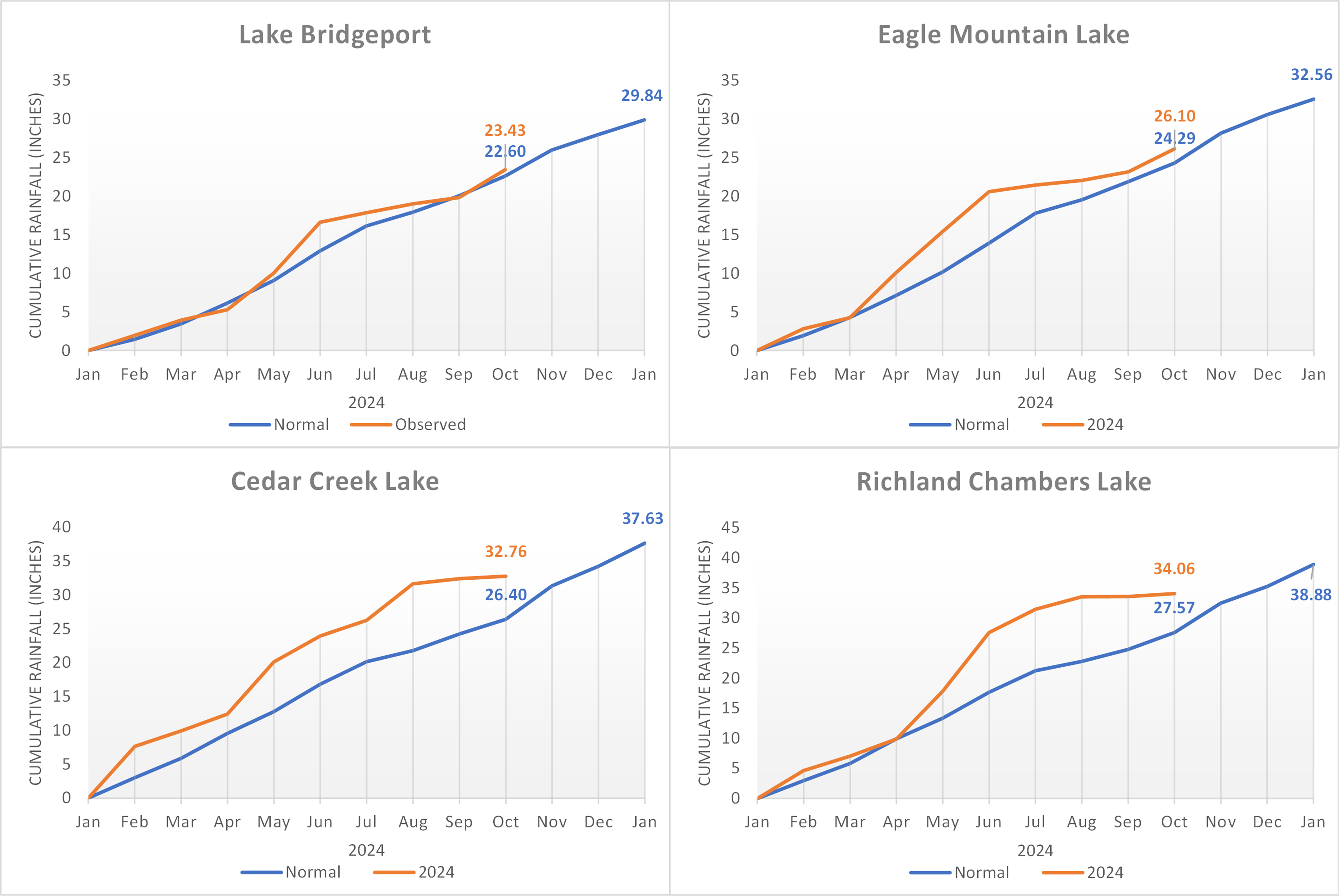
TRWD Lake Rainfall Totals through September 24, 2024
Looking ahead…
The region will get pushed back under a ridge of high pressure and, unfortunately, the trend of hot and dry weather conditions is expected to continue into October and well into the fall and early winter as seen in the latest climate models for the Monthly Temperature Outlook, Monthly Precipitation Outlook, the October-November-December Temperature Outlook and the October-November-December Precipitation Outlook. The below normal precipitation and above normal temperatures across the Central to Southern Great Plains is partly due to the Pacific ENSO La Nina conditions expected to emerge September-November (71% chance). The North Texas winter will continue to be hot and dry if La Nina continues as is expected through March 2025.
With the summer behind us, so is the peak water usage season. This will help slow the downward lake level trend, even with the warm and dry seasonal outlook.
Projections
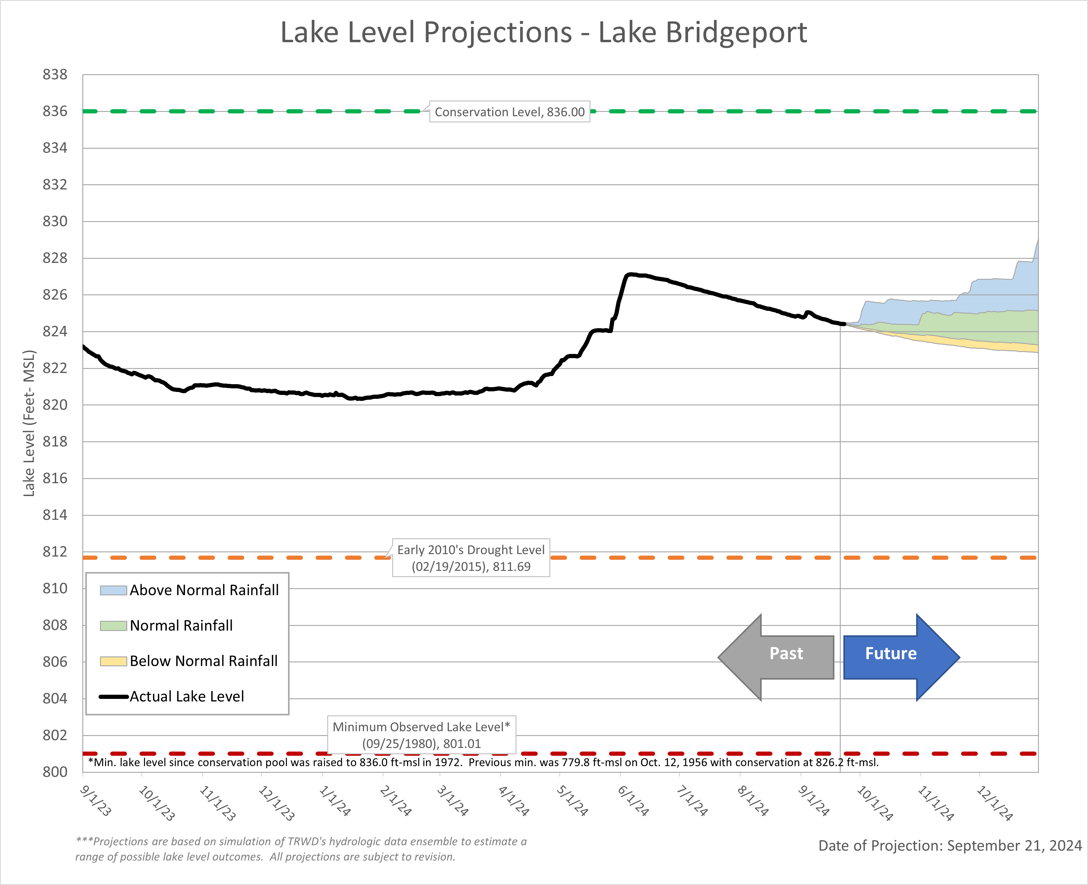
Lake Bridgeport
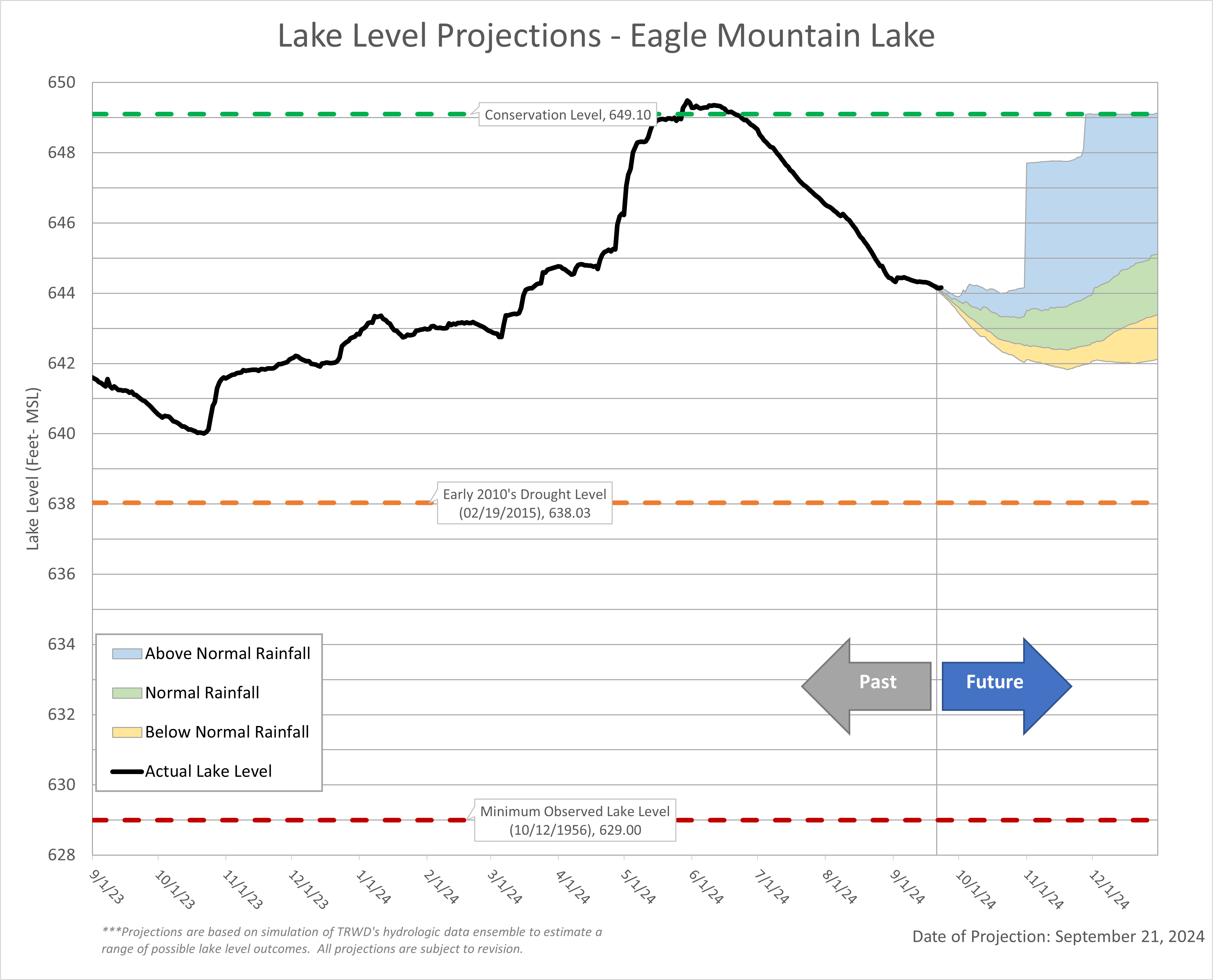
Eagle Mountain Lake
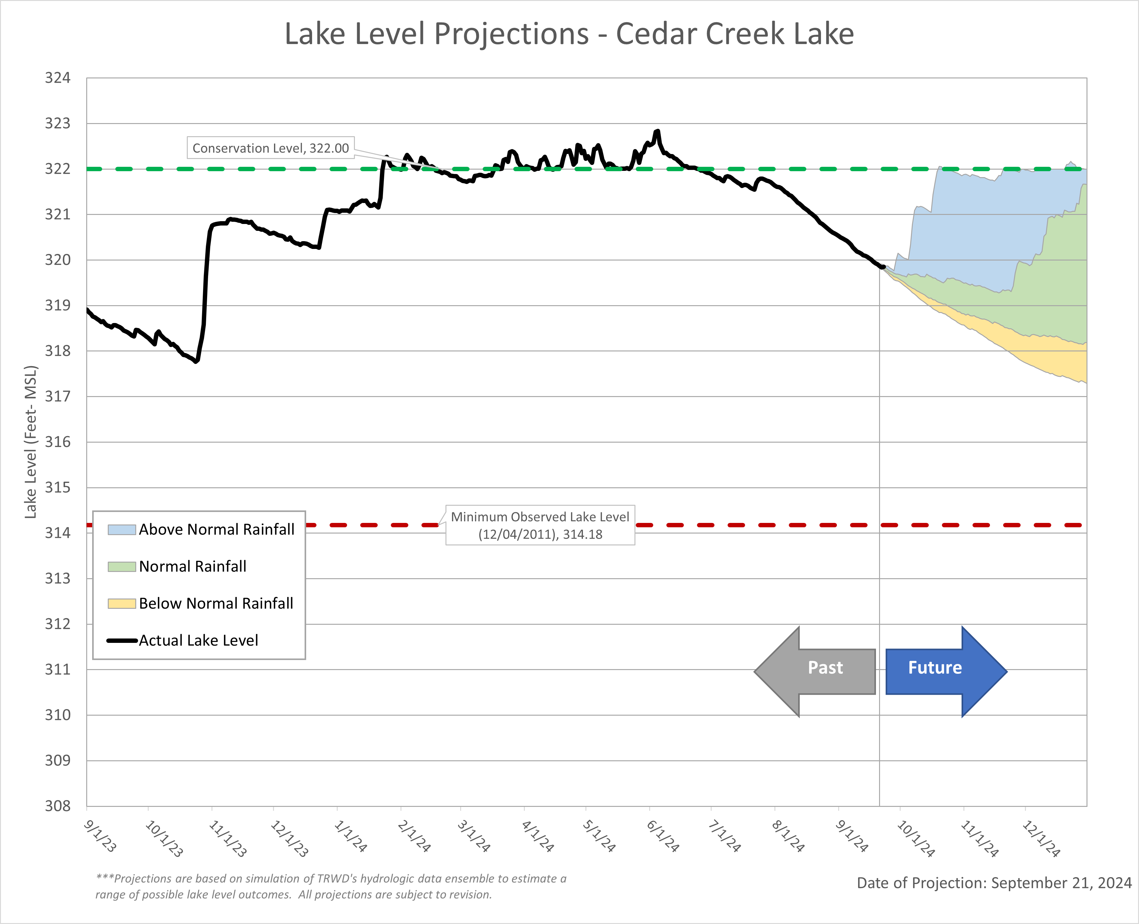
Cedar Creek Lake
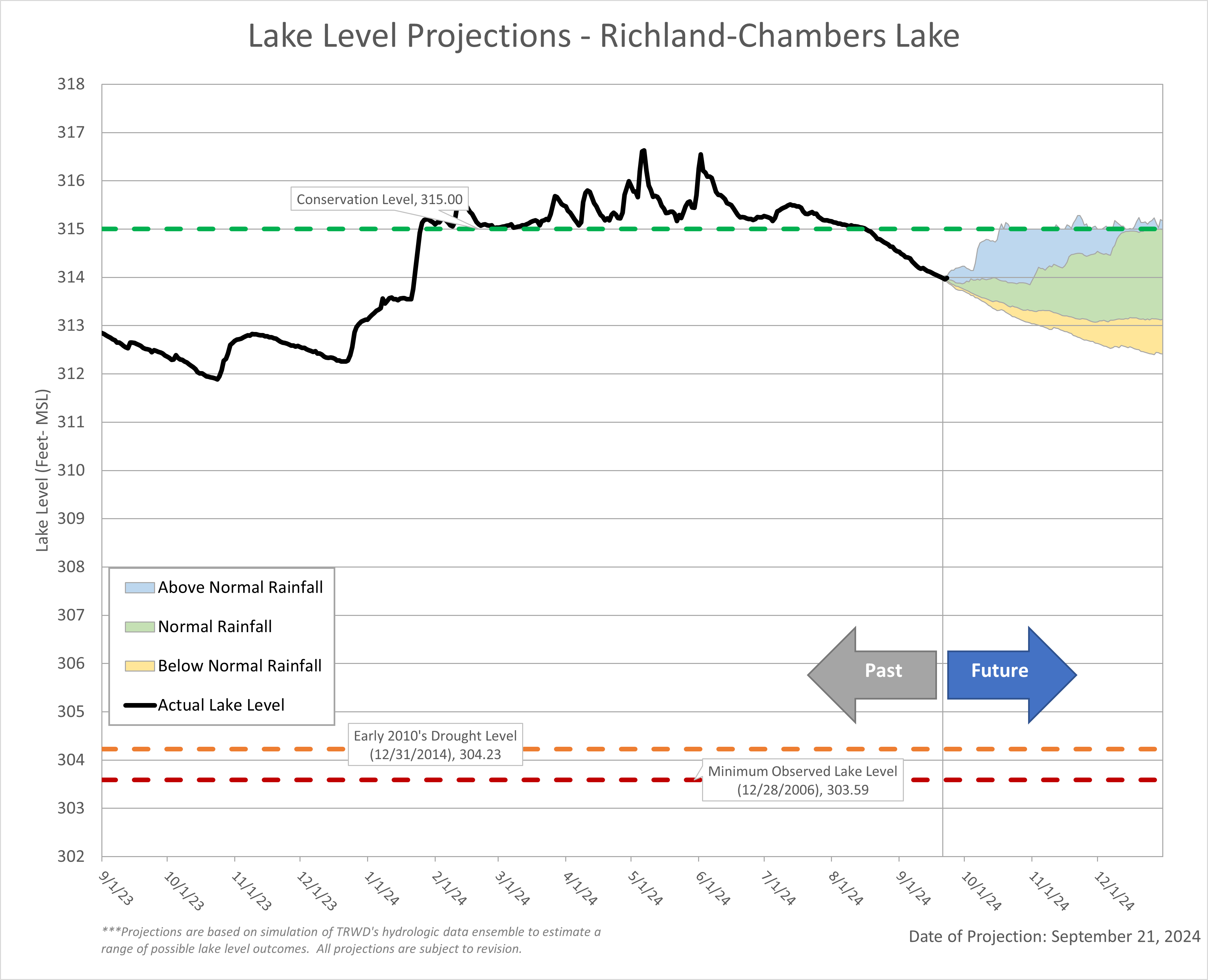
Richland-Chambers Lake